Attention
- IEE with urgent deficiencies (3 urgent and 38 medium-term).
- Possible asbestos due to the year of construction (1960).
- Building energy certification: class E for emissions.
HOUSINGFAX
Private report · indicative · not a diagnosis
Identity and location
Property summary
Dwelling in a predominantly residential property at AV DIFUMINADA 0 (València), built in 1960, with 33 cadastral properties and 2876 m² built, on urban land according to the SIU. The unprotected data from the Cadastre (Catastro) do not include ownership or cadastral value. The purchase requires a priority structural inspection: there is a very high probability of Aluminosis in a building constructed in 1960. It is advisable to check the building's condition before making an offer. Indicative report: not a diagnosis, inspection, valuation, certificate or safety assessment.

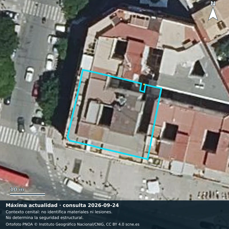
How to read the data
Traffic lightThe purchase requires a priority structural inspection: there is a very high probability of Aluminosis in a building constructed in 1960. It is advisable to check the building's condition before making an offer.
Average closing price per m² for postcode 46000: consult it on the Notaries' Statistical Portal (https://www.penotariado.com/inmobiliario/buscador-precio-vivienda). It is the most significant price reference, because it comes from sales signed before a notary; this report does not reproduce it due to the portal's terms of use.
None of this replaces a viewing or a technical inspection.
AI-assisted wording over verified facts; bands and data come from the engine and the sources, not from the writer.
One row per check: 13 no alert, 9 worth noting and 0 no data. “No data” never means the absence of risk.
✓ no alert⚠ worth noting○ no dataStatus · verdict · key figure
| # | Check | Verdict | Key figure |
|---|---|---|---|
| 01 | Building condition assessment | ⚠ With urgent deficiencies | 3 urgent · 38 medium-term |
| 02 | Risks by year of construction | ⚠ 6 period risks | 1960 period |
| 03 | Aluminosis | ⚠ Very high probability | 1960 construction |
| 04 | Asbestos | ⚠ Possible due to year | Construction 1960 |
| 05 | Cadastral record | ✓ Record consulted | 2876 m² · 33 properties |
| 06 | Energy efficiency | ⚠ Building rating E | Emissions E |
| 07 | Price and market | ✓ Closing price: consult the Notarial Service | 2894 €/m² valued (MIVAU) |
| 08 | Land history | ✓ 4 periods available | 1956–2009 |
| 09 | Land classification | ✓ Urban land | General Plan 1989 |
| 10 | Flood risk | ✓ Outside T10/T100/T500 | T500 less than 500 m away |
| 11 | Geology and drainage | ✓ Consulted | FLOOD SILTS. Sandy silts |
| 12 | Seismicity | ⚠ High hazard | 0,11 g |
| 13 | Ground movement | ✓ Stable | -1,1 mm/year |
| 14 | Surroundings and noise | ✓ Mapped noise | 2 contours |
| 15 | Site constraints | ✓ Watercourse outside the police zone | Watercourse at 629 m |
| 16 | Industrial facilities | ✓ 3 records in the area | 3 E-PRTR < 5 km · 5 in the municipality |
| 17 | Recorded crime | ⚠ Crime above the national average | 74,3 per 1.000 inhabitants (2025, municipality) |
| 18 | Hours of sunlight per façade | ✓ Main façade facing south | 8 h on 21 Jun · 8,8 h on 21 Dec |
| 19 | Roof solar potential | ✓ 1407 kWh/m² per year | 1407 kWh/m²·year |
| 20 | Climate and light pollution | ⚠ Climate checked · very brightly lit surroundings | 18,6 °C · 460 mm/year · 63,27 nW/cm²/sr |
| 21 | Wildfires | ⚠ High fire frequency | 43 incidents 2006-2015 |
| 22 | Radon gas | ✓ Low potential | 101 - 200 Bq/m³ (P90) · no CTE zone |
Each check is developed below with its verdict, its key figure, its source and what is worth checking.
Each check answers a question with its verdict, the key figure, the source and what is worth checking.
Building condition assessment
What to check
On-site review of cracks, damp and installations.
Building Assessment Report (IEE)
The register does not publish the validity of the report.
The IEE is listed as complete and records urgent deficiencies: 3 urgent and 38 medium-term. It includes 21 findings compatible with structural damage and indicates problems in a column, beam and floor slab. Its validity is listed until 9 May 2028.
What to check
Confirm with the owners' association whether the urgent deficiencies in the IEE have been remedied and who bears the cost.
Risks by year of construction
Guidance by age; it does not replace an inspection.
For a building from 1960, the report indicates asbestos, lack of thermal insulation, carbonation and corrosion of reinforcement, lead in water installations, an obsolete electrical installation and the absence of modern seismic regulations. It recommends checking the inventory, samples, energy certificate, building envelope, reinforcement, installations and the area's seismicity.
What to check
No thermal insulation: energy certificate and building envelope.
Aluminosis
There is a very high probability that high-alumina cement elements exist due to the year of construction (1960) and the documented damage. The IEE mentions 21 compatible findings, such as cracks, corrosion of reinforcement and loss of cover. A priority structural inspection is advisable before making an offer.
What to check
Structural inspection by a competent professional before making an offer (joists, floor slabs and defects). Commission a priority inspection of the structural system and the documented damage.
Asbestos
42 years in which fibre cement and asbestos insulation were in common use
Building from 1960, before the total ban on asbestos in Spain (2002): there may be asbestos cement or asbestos-containing insulation.
What to check
Before any renovation, commission an asbestos inventory and sample analysis.
Cadastral record
Non-protected data: no ownership or cadastral value.
33 properties on the plot; uses: Storage-Parking (1), Commercial (6), Residential (26).
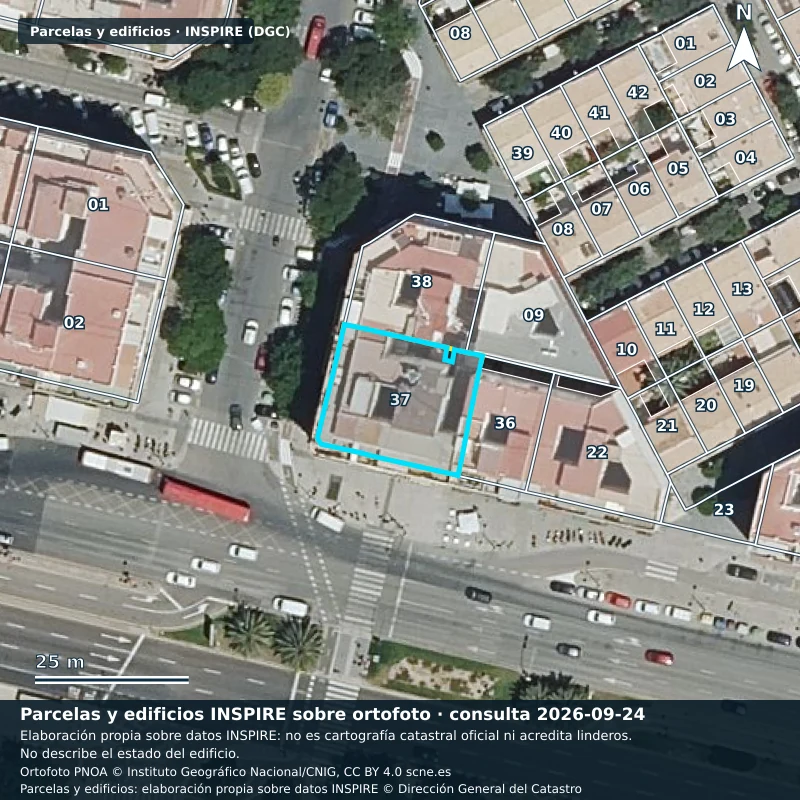
What to check
Compare Cadastre (Catastro) with the land registry extract (nota simple) from the Land Registry.
Energy efficiency
62 certificates on the plot; the letter describes the certified unit on its date.
The dwelling has no certificate registered with the GVA, although 62 certificates are recorded on the plot, mainly with rating E. The rating may not reflect renovations and does not replace the current certificate that the seller must provide.
What to check
Ask the seller for the current energy certificate: the GVA has none registered for this dwelling.
Price and market
The most significant price reference: it comes from sales signed before a notary. This report does not reproduce it because of the portal's terms of use. Check the price of sales signed before a notary at the link above.
98 rented flats in apartment buildings · median area 99 m²
Statistical aggregates: not a valuation, a target price or a discount recommendation.
Minimums under the rule cited in the annex of this check; they do not include paperwork agents, mortgage or renovations.
There is a postal-code closing-price reference that must be consulted in the Notarial Statistical Portal. Recorded valuations place the municipality above the provincial and provincial used-housing references.
Land history
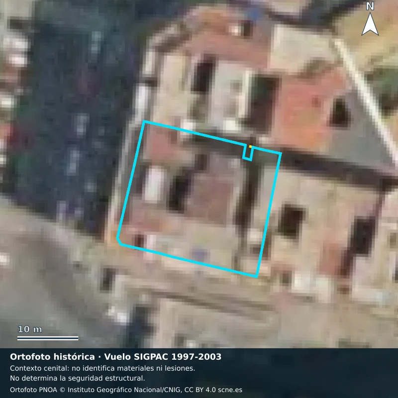
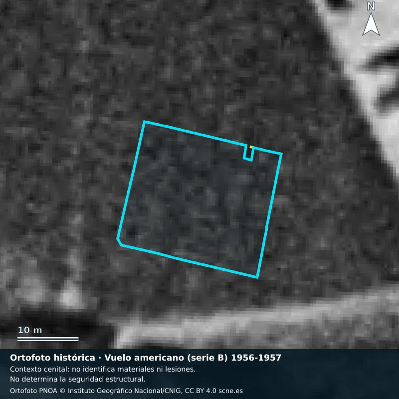
Official orthophotography available for 4 periods (1956, 1998, 2009).
Land classification
The property is listed as urban land and within València's General Plan of 1989. It is advisable to check the occupancy certificate and municipal planning.
Flood risk
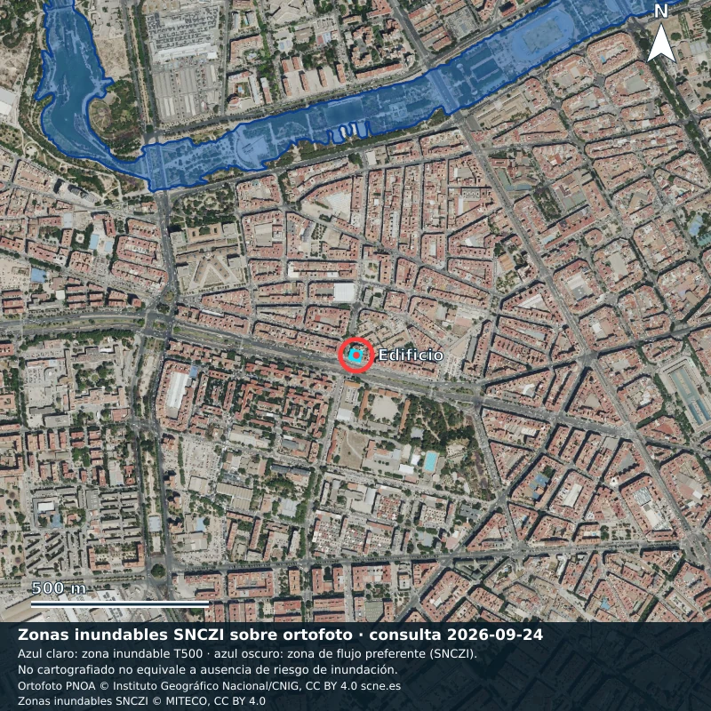
Not mapped does not mean the absence of flood risk.
The specific query returns no intersection with T10, T50, T100, T500 or ARPSI layers.
Geology and drainage
MAGNA50 lithology; it does not infer indoor damp or the condition of the foundations.
MAGNA50 lithology: FLOOD SILTS. Sandy silts.
Seismicity
Modelled hazard (IGN 2016); not a safety assessment.
Reference acceleration 0,11 g (K 1), return period 475 years, IGN 2016 map.
Ground movement
InSAR: observed surface movement, not a foundation assessment.
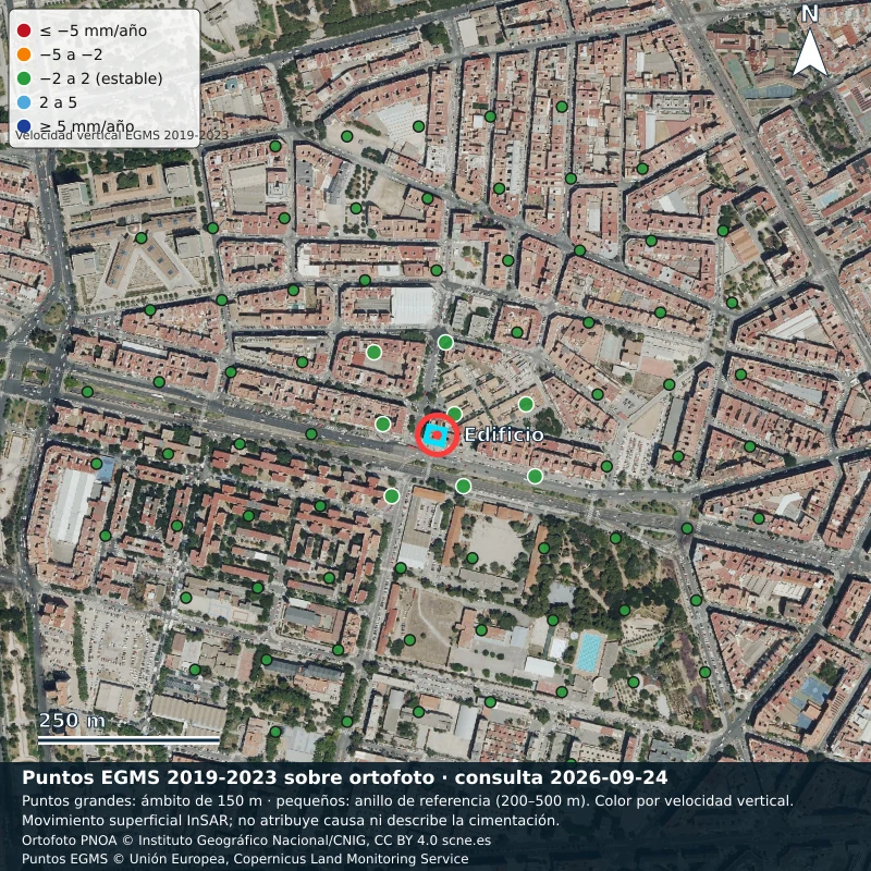
The observed surface movement is stable, with a median of -1,1 mm/year and a dispersion of 0,05 mm/year. This figure does not determine the cause of the movement or the condition of the foundation.
Surroundings and noise
Strategic noise map; it does not describe the actual noise inside the dwelling.
The mapped noise is below 40 dB(A) during the day and at night. The main road is 32 m away; distance does not replace a direct check of noise in the dwelling.
Site constraints
Geometric distances; the thresholds are editorial and pending review.
The nearest official watercourse is 629 m away and outside the indicated police zone. The nearest power line and industrial land are 1501 m and 426 m away; these distances do not measure nuisance or structural safety.
Industrial facilities
Bar colour by distance: green from 2 km; below that it goes from green to orange and red the closer the facility is. Editorial reading criterion, not an official one. With a facility at 1,000 m or less, the check becomes “worth noting”.
Register of facilities required to report emissions; it does not measure nuisance, odour or emissions. 5 in the municipality.
There are 3 E-PRTR facilities within 5 km; the nearest is 1272 m away. The register does not measure nuisance, odours or emissions at the dwelling.
Recorded crime
Municipal or provincial rate: it does not describe the neighbourhood, the street or the building.
Municipal rate for Valencia (INE 46250) of known criminal offences: 74,3 per 1.000 inhabitants in 2025, compared with 50,4 national average (+47,5 %).
Hours of sunlight per façade
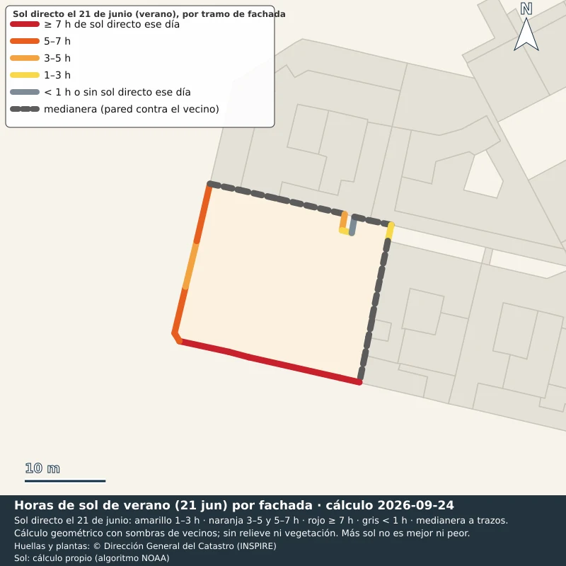
The main façade faces south (11,5 m): it receives 8 h of direct sunlight on 21 June and 8,8 h on 21 December, at its longest section. The calculation is geometric and indicative, not a measurement.
Main façade facing south (11,5 m): 8 h of direct sunlight on 21 June and 8,8 h on 21 December, at its longest section.
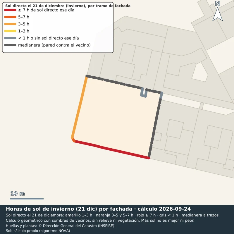
Potential direct sunlight on each façade, calculated over the building's actual outline (cadastral footprints and heights) and the sun's path at this latitude: first on 21 June (summer) and then on 21 December (winter). In the floor plan, party wall shown with dashed lines (wall against the neighbour).
89.7 m of perimeter: which part is façade
| Façade | Summer (21 Jun) | Winter (21 Dec) |
|---|---|---|
| east · 4.1 m | 2.8 h | 0 h |
| south · 22.8 m | 8 h | 8.7 h |
| west · 21 m | 4.5 h | 3 h |
Of the building's 89,7 m outline, 39,4 m (44 %) are party wall with neighbouring buildings, so they receive no sun and do not count as façade. The actual exterior façade is 50,3 m. It has façades only facing east, south and west.
Summer, 21 Jun: 8 h · 11:24–19:24
Winter, 21 Dec: 8.8 h · 08:24–17:12
In total, this façade receives about 3,492 h of direct sunlight per year, according to the model (maximum in March, minimum in June).
Building envelope, footprints and heights: Dirección General del Catastro (INSPIRE). Solar geometry: own calculation (NOAA algorithm). No terrain relief. Indicative results.
Roof solar potential
Editorial calculation with a 0.80 performance ratio for 3 kWp; not a quotation and it does not assess the condition of the roof.
The roof has average annual solar radiation of 1407 kWh/m² and a modelled area of 507 m². The model estimates production of around 3377 kWh per year for a 3 kWp installation, but shadows, the roof and technical and legal feasibility must be checked.
Climate and light pollution
58.57 in the building's cell · very brightly lit urban area
AEMET station VALÈNCIA · 3,1 km · radiance in cells of ~1 km; it does not measure the dwelling's exposure.
Average annual temperature 18,6 °C; warmest month August (26,5 °C) and coldest January (12,1 °C).
Wildfires
Wildland-urban interface: editorial threshold of 400 m (red band), pending review.
The municipality recorded 43 incidents between 2006 and 2015 and 63 between 1996 and 2005, with forest area affected in both periods. The nearest forested area is 184 m away; these data do not describe the building’s specific exposure.
What to check
Confirm fire coverage with the insurer and the municipal prevention plan.
Radon gas
WHO reference: 100 Bq/m³. Indoor measurement is the only way to know the concentration.
The P90 territorial potential is in the 101–200 Bq/m³ category and is classified as low. It does not measure the inside of the dwelling; only a measurement can determine the concentration.
Concrete actions arising from the signals and from the usual due diligence before making an offer.
The data, references and query dates that back each check with data, in the same order and with the same numbering. Each entry links back to its check.
One row per check with its official source, the validity of the data and the status of the query. It is the readable translation of the source record kept with the report; nothing is queried when it is displayed.
| # | Check | Source | Data validity | Query |
|---|---|---|---|---|
| 01 | Building condition assessment | Regional IEE/ITE register (GVA IEEV/GESIEE; RIEECM in the Community of Madrid; Euskoregite in Euskadi): result, condition, accessibility and interventions; supplied PDF | — | consulted |
| 02 | Risks by year of construction | Cadastral year and typology, IEE and indicative table by period | — | consulted |
| 03 | Aluminosis | Cadastral year, IEE/IEEV, supplied documents, declared context and v4 engine | — | consulted |
| 04 | Asbestos | Year of construction; pending public inventories | — | consulted |
| 05 | Cadastral record | Cadastre (Catastro) DGC and INSPIRE; in Euskadi, NORA street directory and provincial cadastres (Bizkaia, Gipuzkoa, Araba) | — | consulted |
| 06 | Energy efficiency | GVA energy efficiency certificate register (ICV WFS) or Euskadi (Open Data Euskadi API); IEEV/ITE energy | Consultation 2026-09-24 | consulted |
| 07 | Price and market | Link to the Statistical Portal of the Notariat (price by postcode not reproduced); MIVAU valuation figures and SERPAVI rent by census tract (provisioned files; tract resolved in the SIU) | — | consulted |
| 08 | Land history | Historical PNOA / IGN Photo Library | — | consulted |
| 09 | Land classification | Urban Information System (SIU), Ministry of Housing and Urban Agenda, open data (Law 37/2007): land class and current planning with designation and year, submitted by each autonomous community | Consultation 2026-09-24 | consulted |
| 10 | Flood risk | MITECO/SNCZI (WFS T10-T500 flood extent, ARPSI and preferential flow; WMS over PNOA orthophoto) | Consultation 2026-09-24 | consulted |
| 11 | Geology and drainage | IGME MAGNA50, IGN MDT25 and IGR Hydrography | Consultation 2026-09-24 | consulted |
| 12 | Seismicity | IGN, National Annex UNE-EN 1998 | Consultation 2026-09-24 | consulted |
| 13 | Ground movement | Copernicus EGMS | Campaign 2019-2023; consultation 2026-09-24 | consulted |
| 14 | Surroundings and noise | MITECO/SICA Strategic Noise Map and OSM (C3 bridge) | — | consulted |
| 15 | Site constraints | IGR Hydrography (IGN/CNIG) through the geology and drainage module; high voltage and industrial estates (OSM, C3) | Consultation 2026-09-24 | consulted |
| 16 | Industrial facilities | GVA RAICV/waste registers and PRTR-Spain/E-PRTR (provisioned dataset) | — | consulted |
| 17 | Recorded crime | Crime Statistics System (Ministry of the Interior) and INE register (provisioned dataset; municipality when the report publishes it, province otherwise) | Year 2025 | consulted |
| 18 | Hours of sunlight per façade | Proprietary geometric calculation based on footprints and floor plans from Cadastre INSPIRE (shadows from neighbouring buildings, NOAA solar algorithm, no terrain relief) | Calculation 2026-09-24 | consulted |
| 19 | Roof solar potential | IGN SOLAR (CNIG, WMS solar-potential) | Consultation 2026-09-24 | consulted |
| 20 | Climate and light pollution | AEMET normal values; VIIRS nighttime light (EOG, provisioned dataset) | Published period unspecified | consulted |
| 21 | Wildfires | EFFIS (C1); EGIF by municipality (provided dataset); nearest forested area (OSM, C3) | — | consulted |
| 22 | Radon gas | CSN P90 potential (C1); CTE DB-HS6 Appendix B (provided dataset) | Query 2026-09-24 | consulted |
Report issued on 24/09/2026 · reference dos_70e390360e8dd59b5052779b6bd01b2b · editorial model 2.9.0 on data model 3.0.0.
Private, indicative and non-diagnostic report. This document is an informative and indicative report, prepared automatically by HOUSINGFAX from official public sources consulted on the date indicated in each check. It is not a diagnosis, inspection, valuation, certificate or safety opinion, does not constitute technical, legal, planning, environmental or financial advice, and does not replace a viewing, an in-person inspection by a qualified professional, the land registry extract (nota simple) or the corresponding administrative checks.
Each check indicates its source, date and status, and the data exclusively reflect the period and scope specified in each section. Official sources may contain errors, omissions or update delays not attributable to HOUSINGFAX. A «no data» never means absence of risk, and no figure in this report is a valuation or target price. The bands and thresholds identified as editorial are in-house reading criteria, not regulatory classifications. The recommendations under «What to check» and «Points to check» are general guidance that does not take into account the particular circumstances of the property or buyer. The wording is AI-assisted based on verified facts; bands and data come from the engine and sources, not the writer. The purchase decision and prior checks are the sole responsibility of the interested party, and this document should not be the only element on which that decision is based.
Sources cited in each check: Regional IEE/ITE register (GVA IEEV/GESIEE; RIEECM in the Community of Madrid; Euskoregite in Euskadi): result, condition, accessibility and interventions; supplied PDF; Cadastral year and typology, IEE and indicative table by period; Cadastral year, IEE/IEEV, supplied documents, declared context and v4 engine; Year of construction; pending public inventories; Cadastre (Catastro) DGC and INSPIRE; in Euskadi, NORA street directory and provincial cadastres (Bizkaia, Gipuzkoa, Araba); GVA energy efficiency certificate register (ICV WFS) or Euskadi (Open Data Euskadi API); IEEV/ITE energy; Link to the Statistical Portal of the Notariat (price by postcode not reproduced); MIVAU valuation figures and SERPAVI rent by census tract (provisioned files; tract resolved in the SIU); Historical PNOA / IGN Photo Library; Urban Information System (SIU), Ministry of Housing and Urban Agenda, open data (Law 37/2007): land class and current planning with designation and year, submitted by each autonomous community; MITECO/SNCZI (WFS T10-T500 flood extent, ARPSI and preferential flow; WMS over PNOA orthophoto); IGME MAGNA50, IGN MDT25 and IGR Hydrography; IGN, National Annex UNE-EN 1998; Copernicus EGMS; MITECO/SICA Strategic Noise Map and OSM (C3 bridge); IGR Hydrography (IGN/CNIG) through the geology and drainage module; high voltage and industrial estates (OSM, C3); GVA RAICV/waste registers and PRTR-Spain/E-PRTR (provisioned dataset); Crime Statistics System (Ministry of the Interior) and INE register (provisioned dataset; municipality when the report publishes it, province otherwise); Proprietary geometric calculation based on footprints and floor plans from Cadastre INSPIRE (shadows from neighbouring buildings, NOAA solar algorithm, no terrain relief); IGN SOLAR (CNIG, WMS solar-potential); AEMET normal values; VIIRS nighttime light (EOG, provisioned dataset); EFFIS (C1); EGIF by municipality (provided dataset); nearest forested area (OSM, C3); CSN P90 potential (C1); CTE DB-HS6 Appendix B (provided dataset).
HOUSINGFAX · Private report · Engine 4.0.0 · Report 1 · 2026-09-24 · RC20 0000000AA0000A0003AA · AV DIFUMINADA 0
Everything the system retrieved for this property, with evidence, provenance and the status of each source. It is the detail that backs the checks above.
very high band of compatibility with possible signs related to high-alumina cement. It is an ordinal band, not a percentage or a diagnosis.
The preliminary probability sits in a very high band because the confirmed year of construction is 1960 and the driving findings are concentrated in age of the building. As outdoor context, the reference period published without specification from VALÈNCIA records an annual mean of 18.6 °C and 460.1 mm of precipitation; these data do not score and do not describe the inside of the building. Overall, the summarised situation of the building falls under unknown deterioration, an urgency of priority inspection and high confidence.
Compatible presence
Very high1 linked pieces of evidenceConditional deterioration
Unknown0 linked pieces of evidenceCurrent urgency
Priority inspection0 linked pieces of evidenceConfidence
High1 linked pieces of evidenceThe four axes are presented separately. No band is a percentage, nor does it confirm or rule out high-alumina cement.
The official sources already consulted are shown with coverage, validity and limitations. The remaining modules are still pending and none of these contexts scores for HAC.
This section has data with recorded provenance.
SNCZI/MITECO: coverage consulted with no point intersection.
Fuente: MITECO/SNCZI · query 2026-09-24 · point_intersection · Does not score for HAC.
No cartografiado no equivale a ausencia de riesgo de inundación.
This section is not compatible with the current scope or coverage.
LEGITIMATE_QUERY_ENDPOINT_AND_LICENSE_NOT_VERIFIEDThis section has data with recorded provenance.
IGN: PGA 0.11 g · K 1.
Return period 475 years · map 2016 · Anejo Nacional UNE-EN 1998.
modelled_grid_interpolation · inverse_distance · 0.1° grid · ETRS89 / EPSG:4326 · query 2026-09-24.
Malla oficial IGN de 0,1°.
Fuente: Instituto Geográfico Nacional (IGN) · Orden FOM/2807/2015; compatible CC BY 4.0.
Peligrosidad modelizada; terreno local y tipología del edificio desconocidos. No es un dictamen de seguridad.
Does not score for high-alumina cement (HAC).
This section has data with recorded provenance.
EGMS: vertical median -1.1 mm/year · MAD 0.05 mm/year.
Reference -1.1 mm/year at a median distance of 379.3 m · gradient magnitude 0 mm/year/km · 79 points (8 area and 66 ring).
Product L3 ORTHO-UP · release 2019-2023 · 100 m grid · ETRS89-LAEA / EPSG:3035.
Distance to the nearest point 39.2 m · median uncertainty 0 mm/year (application threshold 5 mm/year) · query 2026-09-24.
Metrics derived by HOUSINGFAX; the median, MAD and gradient magnitude are not an official EGMS methodology.
Generated using European Union's Copernicus Land Monitoring Service information; derived application metrics · Copernicus Land Monitoring Service free, full and open data policy · DOI https://doi.org/10.2909/4a14a29b-7db7-40e4-81ad-df3aa8dfbc6f.
Movimiento superficial observado por InSAR; no atribuye causa, no describe por sí solo la cimentación y no es un dictamen de seguridad.
Does not score for high-alumina cement (HAC).
This section has data with recorded provenance.
IGME MAGNA50: LIMOS DE INUNDACIàN. Limos arenosos · unit 16 · sheet 722 · scale 1:50.000.
IGN MDT25: elevation 23 m · local slope 0 % · relative elevation 0 m.
Reproducible method: 7×7 window, 25 m grid and median of the 2–3 cell ring.
IGR Hydrography: 629.3 m to the nearest official watercourse.
Query 2026-09-24 · unidad cartográfica superficial · 25 m · geometría vectorial oficial dentro de búsqueda acotada.
Fuentes: IGME-CSIC MAGNA 1:50.000 e IGN/CNIG MDT25 e IGR Hidrografía · IGME condiciones de uso; IGN/CNIG CC BY 4.0 scne.es.
Contexto exterior y métricas de aplicación: no infiere humedad interior, estado de cimentación ni seguridad estructural. Not mapped does not mean the absence of constraints.
Does not score for high-alumina cement (HAC).
This section has data with recorded provenance.
Categoría territorial CSN 101 - 200 Bq/m³ (P90).
CSN: territorial category 101 - 200 Bq/m³ (P90).
Unidad cartográfica oficial CSN activa · unidad cartográfica territorial · query 2026-09-24.
Mapa del Potencial de Radón de España CSN, 2017 · Ley 37/2007 (régimen general; el CSN no publica licencia específica); cita exigida por el CSN.
Potencial territorial P90; no es una medición de radón interior. Territorial P90 potential; not an indoor radon measurement.
Does not score for high-alumina cement (HAC).
This section has data with recorded provenance.
Lden: <40 dB(A) (2022; SICA/CEDEX/MITECO · Ayuntamiento de Valencia). Lnight: <40 dB(A) (2022; SICA/CEDEX/MITECO · Ayuntamiento de Valencia).
Lden: <40 dB(A) (2022; SICA/CEDEX/MITECO · Ayuntamiento de Valencia).
Ayuntamiento de Valencia; contornos importados, no cobertura nacional completa; funcionamiento 2021 · SICA F4 MER2022 360e7f788717.
Metadato SICA: No se aplican condiciones. Uso privado; publicación comercial no activada..
Lnight: <40 dB(A) (2022; SICA/CEDEX/MITECO · Ayuntamiento de Valencia).
Ayuntamiento de Valencia; contornos importados, no cobertura nacional completa; funcionamiento 2021 · SICA F4 MER2022 360e7f788717.
Metadato SICA: No se aplican condiciones. Uso privado; publicación comercial no activada..
Query 2026-09-24 · outdoor mapped contour.
Ruido exterior cartografiado del año indicado, no medición interior ni actual. Sin contorno importado no significa silencio. Fuentes municipales complementarias, no SICA.
Does not score for high-alumina cement (HAC).
This section is part of the structure of the assessment, but it does not yet query a source or take part in any decision.
SOURCE_CONNECTOR_NOT_IMPLEMENTEDThe confirmed facts and the pending checks help prepare due diligence. No target price, discount or CAPEX is calculated.
Precio medio de cierre por m² del código postal 46000: consúltelo en el Portal Estadístico del Notariado (https://www.penotariado.com/inmobiliario/buscador-precio-vivienda). Es la referencia de precio más significativa, porque procede de las compraventas firmadas ante notario; este informe no la reproduce por las condiciones de uso del portal.
Valor orientativo de la vivienda: multiplique ese €/m² por la superficie catastral de la vivienda (no identificada de forma inequívoca en este informe). Ahí es donde se puede calcular realmente el valor del inmueble; este informe no hace esa multiplicación.
This section is part of the structure of the assessment, but it does not yet query a source or take part in any decision.
NEGOTIATION_ENGINE_NOT_IMPLEMENTEDAV DIFUMINADA 0
RC20 · 0000000AA0000A0003AA
The scope is limited to the building linked to this private file; it is not generalised to neighbouring properties or buildings.
Year of construction: 1960 · completeness complete.
33 units · 2,876 m² built (completeness complete).
Published floors: 01, 02, 03, 04, 05, 06, 07, B0, BO.
Uses: Almacen-Estacionamiento (1) · Comercial (6) · Residencial (26).
| Reference | Location | Use | Area | Year | Share |
|---|---|---|---|---|---|
| 0000000AA0000A0001AA | AV DIFUMINADA 0Stair 1 · Fl. B0 · Door 01 | Comercial | 71 m² | 1960 | 2.86 % |
| 0000000AA0000A0002AA | AV DIFUMINADA 0Stair 1 · Fl. B0 · Door 02 | Comercial | 44 m² | 1960 | 1.77 % |
| 0000000AA0000A0003AA | AV DIFUMINADA 0Stair 1 · Fl. BO · Door 03 | Comercial | 131 m² | 1960 | 5.27 % |
| 0000000AA0000A0004AA | AV DIFUMINADA 0Stair 1 · Fl. BO · Door 04 | Comercial | 82 m² | 1960 | 3.3 % |
| 0000000AA0000A0005AA | AV DIFUMINADA 0Stair 1 · Fl. B0 · Door 05 | Comercial | 25 m² | 1960 | 1.01 % |
| 0000000AA0000A0006AA | AV DIFUMINADA 0Stair 1 · Fl. BO · Door 06 | Almacen-Estacionamiento | 21 m² | 1960 | 0.84 % |
| 0000000AA0000A0007AA | AV DIFUMINADA 0Stair 1 · Fl. B0 · Door 07 | Comercial | 31 m² | 1960 | 1.25 % |
| 0000000AA0000A0008AA | AV DIFUMINADA 0Stair 1 · Fl. 01 · Door 01 | Residencial | 96 m² | 1960 | 3.21 % |
| 0000000AA0000A0009AA | AV DIFUMINADA 0Stair 1 · Fl. 01 · Door 02 | Residencial | 90 m² | 1960 | 3.59 % |
| 0000000AA0000A0010AA | AV DIFUMINADA 0Stair 1 · Fl. 01 · Door 03 | Residencial | 103 m² | 1960 | 3.21 % |
| 0000000AA0000A0011AA | AV DIFUMINADA 0Stair 1 · Fl. 01 · Door 04 | Residencial | 90 m² | 1960 | 3.39 % |
| 0000000AA0000A0012AA | AV DIFUMINADA 0Stair 1 · Fl. 02 · Door 05 | Residencial | 81 m² | 1960 | 3.21 % |
| 0000000AA0000A0013AA | AV DIFUMINADA 0Stair 1 · Fl. 02 · Door 06 | Residencial | 98 m² | 1960 | 3.39 % |
| 0000000AA0000A0014AA | AV DIFUMINADA 0Stair 1 · Fl. 02 · Door 07 | Residencial | 103 m² | 1960 | 3.21 % |
| 0000000AA0000A0015AA | AV DIFUMINADA 0Stair 1 · Fl. 02 · Door 08 | Residencial | 98 m² | 1960 | 2.69 % |
| 0000000AA0000A0016AA | AV DIFUMINADA 0Stair 1 · Fl. 03 · Door 09 | Residencial | 81 m² | 1960 | 3.21 % |
| 0000000AA0000A0017AA | AV DIFUMINADA 0Stair 1 · Fl. 03 · Door 10 | Residencial | 98 m² | 1960 | 3.39 % |
| 0000000AA0000A0018AA | AV DIFUMINADA 0Stair 1 · Fl. 03 · Door 11 | Residencial | 103 m² | 1960 | 3.21 % |
| 0000000AA0000A0019AA | AV DIFUMINADA 0Stair 1 · Fl. 03 · Door 12 | Residencial | 98 m² | 1960 | 2.69 % |
| 0000000AA0000A0020AA | AV DIFUMINADA 0Stair 1 · Fl. 04 · Door 13 | Residencial | 81 m² | 1960 | 3.21 % |
| 0000000AA0000A0021AA | AV DIFUMINADA 0Stair 1 · Fl. 04 · Door 14 | Residencial | 98 m² | 1960 | 3.39 % |
| 0000000AA0000A0022AA | AV DIFUMINADA 0Stair 1 · Fl. 04 · Door 15 | Residencial | 103 m² | 1960 | 3.21 % |
| 0000000AA0000A0023AA | AV DIFUMINADA 0Stair 1 · Fl. 04 · Door 16 | Residencial | 98 m² | 1960 | 2.69 % |
| 0000000AA0000A0024AA | AV DIFUMINADA 0Stair 1 · Fl. 05 · Door 17 | Residencial | 81 m² | 1960 | 3.21 % |
| 0000000AA0000A0025AA | AV DIFUMINADA 0Stair 1 · Fl. 05 · Door 18 | Residencial | 98 m² | 1960 | 3.39 % |
| 0000000AA0000A0026AA | AV DIFUMINADA 0Stair 1 · Fl. 05 · Door 19 | Residencial | 103 m² | 1960 | 3.21 % |
| 0000000AA0000A0027AA | AV DIFUMINADA 0Stair 1 · Fl. 05 · Door 20 | Residencial | 98 m² | 1960 | 2.69 % |
| 0000000AA0000A0028AA | AV DIFUMINADA 0Stair 1 · Fl. 06 · Door 21 | Residencial | 76 m² | 1960 | 3.21 % |
| 0000000AA0000A0029AA | AV DIFUMINADA 0Stair 1 · Fl. 06 · Door 22 | Residencial | 90 m² | 1960 | 3.39 % |
| 0000000AA0000A0030AA | AV DIFUMINADA 0Stair 1 · Fl. 06 · Door 23 | Residencial | 95 m² | 1960 | 3.21 % |
| 0000000AA0000A0031AA | AV DIFUMINADA 0Stair 1 · Fl. 06 · Door 24 | Residencial | 90 m² | 1960 | 2.69 % |
| 0000000AA0000A0032AA | AV DIFUMINADA 0Stair 1 · Fl. 07 · Door 25 | Residencial | 110 m² | 1960 | 3.9 % |
| 0000000AA0000A0033AA | AV DIFUMINADA 0Stair 1 · Fl. 07 · Door 26 | Residencial | 111 m² | 1960 | 3.9 % |
IEE/P/0000/00/000/0000000 · year 1960 · validity 2028-05-09 10:00:33 AD · assessment Completo.
Urgent interventions: 3 · INTu sin ejecutar. Medium term: 38. Coverage retrieved: partial.
IEEV visual resources Integration safely disabledSAFE_DISABLED / IEEV_IMAGE_REUSE_NOT_APPROVED Until reuse is approved, no photographs are downloaded or included.
Documentary inventory retrieved 2 images and 0 documents Kept solely as a provenance reference. Integration safely disabledSAFE_DISABLED
Emisiones — Calefacción: no published data
Emisiones — Refrigeración: no published data
Emisiones — ACS: no published data
Emisiones — Globales: no published data
Consumo de energía primaria no renovable — Calefacción: no published data
Consumo de energía primaria no renovable — Refrigeración: no published data
Consumo de energía primaria no renovable — ACS: no published data
Consumo de energía primaria no renovable — Globales: no published data
Demanda energética de calefacción y refrigeración — Calefacción: no published data
Demanda energética de calefacción y refrigeración — Refrigeración: no published data
Texto íntegro del acta: El zaguán y los elementos comunes adscritos al mismo presentan barreras arquitectónicas en espacios comunes del edificio. A continuación se muestran las intervenciones propuestas susceptibles de ser consideradas ajustes razonables para eliminar las barreras arquitectónicas existentes en los espacios comunes del edificio:
Official documentary information. On its own it does not constitute a diagnosis of high-alumina cement.
One current image and up to two comparable historical ones, with the same envelope derived from the PostGIS geometry.
VALÈNCIA · 84163.1 km · 13 m · reference period published without specification
Annual mean: 18.6 °C · 460.1 mm
Outdoor relative humidity is available for all twelve months.
Environmental context. It does not prove indoor damp or structural condition, does not confirm deterioration and does not diagnose HAC.
Evidence: aemet_station_91aa7754a7671f1e0d9b · aemet_normals_d7653e87966cd812c145Ground elevation: 23 m
IGN/CNIG MDT25 WCS · 24/09/2026 · España según cobertura publicada del MDT25; paso de malla aproximado de 25 m
Elevación exterior del terreno modelada; no es una cota topográfica certificada ni describe el interior del edificio. Does not score for HAC.
Distance to the coast Source not integrated or not supportedUNSUPPORTED / OFFICIAL_REUSABLE_VECTOR_ENDPOINT_NOT_VERIFIED Does not score for HAC.
Radon and CTE Independent context, with no causal relation to HAC. Integration safely disabledSAFE_DISABLED / INDEPENDENT_CONTEXT_NOT_INTEGRATED
Outdoor context. It does not prove indoor exposure, deterioration, material or structural safety.
The bands come exclusively from the deterministic engine. The driving evidence for this version is:
“Not confirmed” does not mean “does not exist”. It means the data is unknown, was not found at that source or is in conflict.
| Fact | Value | Status | Source and coverage | Query | Quality |
|---|---|---|---|---|---|
| cadastral_referenceev_0c49f90aa31cb088d5fd5817a537c0ac | 0000000AA0000A0003AA | Confirmed by the source | public_official_building_resolutionResolución normalizada de Catastro e INSPIRE confirmada antes del cribado · official_api | 24/09/2026 | high · high |
| official_addressev_6521bbf2de125be0a341411c40846760 | AV DIFUMINADA 0 | Confirmed by the source | public_official_building_resolutionResolución normalizada de Catastro e INSPIRE confirmada antes del cribado · official_api | 24/09/2026 | high · high |
| climate_normalev_02fbd28186d948e404872c4b9876983d | AEMET OpenData AEMET_PUBLISHED_PERIOD_UNSPECIFIED; annual mean 18.6 C; annual precipitation 460.1 mm; monthly seasonality available | Confirmed by the source | climate_normalCobertura declarada por el colector del expediente · open_dataset | 24/09/2026 | non_scorable · medium |
| ieev_construction_yearev_3288c8ff444062a397917107159d138c | 1960 | Confirmed by the source | gva_ieev_wfs_inventoryCobertura declarada por el colector del expediente · official_document | 24/09/2026 | non_scorable · medium |
| catastro_building_inventoryev_33b4a67c6058a1db2793f0d1b0a3ce18 | Structured data available | Confirmed by the source | catastro_building_inventoryCobertura declarada por el colector del expediente · official_document | 24/09/2026 | non_scorable · medium |
| ieev_record_statusev_3a548e9b4dbb0766ba2612b4247df7dc | known | Confirmed by the source | gva_ieev_wfs_inventoryCobertura declarada por el colector del expediente · official_document | 24/09/2026 | non_scorable · medium |
| cadastral_surface_totalev_50058b64f78bc6062603a04f0a9933ac | 2876 | Confirmed by the source | catastro_building_inventoryCobertura declarada por el colector del expediente · official_document | 24/09/2026 | non_scorable · medium |
| ieev_conservation_findingsev_5005b3964c5936d1d9f6bc242f52bb50 | Structured data available | Confirmed by the source | gva_gesiee_complete_reportCobertura declarada por el colector del expediente · official_document | 24/09/2026 | non_scorable · medium |
| ieev_energy_consumption_ratingev_7fe44ea82a39eb641bcf42758d9d439f | — | Not confirmed · data unknown | gva_gesiee_complete_reportCobertura declarada por el colector del expediente · official_document | 24/09/2026 | non_scorable · very_low |
| ieev_medium_term_intervention_countev_9468c29bf81412558cdaf4027413bcdd | 38 | Confirmed by the source | gva_ieev_wfs_inventoryCobertura declarada por el colector del expediente · official_document | 24/09/2026 | non_scorable · medium |
| ieev_energy_emissions_ratingev_aaf41a1f759d926bd43360a65d24fff2 | E | Confirmed by the source | gva_gesiee_complete_reportCobertura declarada por el colector del expediente · official_document | 24/09/2026 | non_scorable · medium |
| construction_yearev_b07e52b3bb33f868fe183ad31517dd33 | 1960 | Confirmed by the source | catastro_building_inventoryCobertura declarada por el colector del expediente · official_document | 24/09/2026 | non_scorable · medium |
| ieev_urgent_intervention_stateev_b2cc4d1744a36decf912978847191d1d | INTu sin ejecutar | Confirmed by the source | gva_ieev_wfs_inventoryCobertura declarada por el colector del expediente · official_document | 24/09/2026 | non_scorable · medium |
| construction_yearev_b64ad63d60a5c893338e9e23c84dd43f | 1960 | Confirmed by the source | gva_ieev_wfs_inventoryCobertura declarada por el colector del expediente · official_document | 24/09/2026 | non_scorable · medium |
| ieev_urgent_intervention_countev_baf26b224bc18f119417401bc4667ae7 | 3 | Confirmed by the source | gva_ieev_wfs_inventoryCobertura declarada por el colector del expediente · official_document | 24/09/2026 | non_scorable · medium |
| gva_gesiee_complete_reportev_bd00d862c555845e0f989ed43b806574 | Structured data available | Confirmed by the source | gva_gesiee_complete_reportCobertura declarada por el colector del expediente · official_document | 24/09/2026 | non_scorable · medium |
| gva_ieev_wfs_inventoryev_ceedd36954fd6089124bb516d1ded08c | Structured data available | Confirmed by the source | gva_ieev_wfs_inventoryCobertura declarada por el colector del expediente · official_document | 24/09/2026 | non_scorable · medium |
| cadastral_unit_countev_e1b09afdc399d4f3422028310f3afb74 | 33 | Confirmed by the source | catastro_building_inventoryCobertura declarada por el colector del expediente · official_document | 24/09/2026 | non_scorable · medium |
| ieev_accessibility_statusev_e1f5da30432ebc7d2944b4b906771662 | 1 official sections recovered | Confirmed by the source | gva_gesiee_complete_reportCobertura declarada por el colector del expediente · official_document | 24/09/2026 | non_scorable · medium |
| ieev_evaluation_completenessev_e652e7925efc1051a05704fe6313b335 | Completo | Confirmed by the source | gva_ieev_wfs_inventoryCobertura declarada por el colector del expediente · official_document | 24/09/2026 | non_scorable · medium |
| ieev_expiry_dateev_ef1a9a238a21467459d4c2cde1569b79 | 2028-05-09 10:00:33 AD | Confirmed by the source | gva_ieev_wfs_inventoryCobertura declarada por el colector del expediente · official_document | 24/09/2026 | non_scorable · medium |
| sede_facade_imageryev_7c7e1720a004d9d4efaa9601542913ea | Structured data available | Confirmed by the source | sede_facade_imageryCobertura declarada por el colector del expediente · gis | 24/09/2026 | non_scorable · medium |
| noise_miteco_sicaev_19e56511c9f6f78c8ffd0d9071ac02d1 | [{"artifactSha256":"360e7f78871707428464e5c3d1c1a51405a5b5153f01bebcb29693c95fefd9ff","attribution":"SICA/CEDEX/MITECO · Ayuntamiento de Valencia","band":{"label":"<40 dB(A)","lowerDb":null,"lowerInclusive":null,"unit":"dB(A)","upperDb":40,"upperInclusive":false},"coverage":"Ayuntamiento de Valencia; contornos importados, no cobertura nacional completa; funcionamiento 2021","featureId":"15","geometryType":"MultiPolygon","indicator":"Lden","layerName":"NoiseContours_allSourcesInAgglomeration_Lden","license":"Metadato SICA: No se aplican condiciones. Uso privado; publicación comercial no activada.","matchType":"point_intersection","referenceYear":2022,"sourceCode":"MITECO_SICA","sourceUrl":"https://sicaweb.cedex.es/wp-content/themes/sica-cedex/dl.php?f=L2hvbWUvc2ljYXdlYi9kb21haW5zL3NpY2F3ZWIuY2VkZXguZXMvcHVibGljL3BhbmVsL3VwbG9hZHMvZnRwLzIwMjMtMDctMjYtMTItMDQtNDUtQXl0VkFMX01FUl9DRS56aXA&n=VmFsZW5jaWEuemlw","sourceVersion":"SICA F4 MER2022 360e7f788717"},{"artifactSha256":"360e7f78871707428464e5c3d1c1a51405a5b5153f01bebcb29693c95fefd9ff","attribution":"SICA/CEDEX/MITECO · Ayuntamiento de Valencia","band":{"label":"<40 dB(A)","lowerDb":null,"lowerInclusive":null,"unit":"dB(A)","upperDb":40,"upperInclusive":false},"coverage":"Ayuntamiento de Valencia; contornos importados, no cobertura nacional completa; funcionamiento 2021","featureId":"18","geometryType":"MultiPolygon","indicator":"Lnight","layerName":"NoiseContours_allSourcesInAgglomeration_Lnight","license":"Metadato SICA: No se aplican condiciones. Uso privado; publicación comercial no activada.","matchType":"point_intersection","referenceYear":2022,"sourceCode":"MITECO_SICA","sourceUrl":"https://sicaweb.cedex.es/wp-content/themes/sica-cedex/dl.php?f=L2hvbWUvc2ljYXdlYi9kb21haW5zL3NpY2F3ZWIuY2VkZXguZXMvcHVibGljL3BhbmVsL3VwbG9hZHMvZnRwLzIwMjMtMDctMjYtMTItMDQtNDUtQXl0VkFMX01FUl9DRS56aXA&n=VmFsZW5jaWEuemlw","sourceVersion":"SICA F4 MER2022 360e7f788717"}] | Confirmed by the source | noise_miteco_sicaCobertura declarada por el colector del expediente · gis | 24/09/2026 | non_scorable · medium |
| radon_csn_2017ev_c77f7abf6741e031fa3941d621f8464f | 101 - 200 | Confirmed by the source | radon_csn_2017Cobertura declarada por el colector del expediente · open_dataset | 24/09/2026 | non_scorable · medium |
| c3_green_spaceev_21d43a5d6ed3a2ba9d2ed9b92b52fc6f | — | Not confirmed · data unknown | c3_green_spaceCobertura declarada por el colector del expediente · open_dataset | 24/09/2026 | non_scorable · very_low |
| c3_network_travel_timesev_297604176a39e1dfcc34c38d3775d80f | 0ad0eae24056339ac0a0927ba84f5320431d8f73549a156031b7eda2e7b38362 | Confirmed by the source | c3_network_travel_timesCobertura declarada por el colector del expediente · open_dataset | 24/09/2026 | non_scorable · medium |
| c3_daily_servicesev_6831194c87b035988dc3f1042c98b230 | 8fdbfa9b6d2adfe5c910a36bcb25ff3464b7ebcc9af7b13ffc7345e5ec422915 | Confirmed by the source | c3_daily_servicesCobertura declarada por el colector del expediente · open_dataset | 24/09/2026 | non_scorable · medium |
| geology_igme_magna50ev_137623b91a64952e76caf44105f3e086 | 16:LIMOS DE INUNDACIàN. Limos arenosos | Confirmed by the source | geology_igme_magna50Cobertura declarada por el colector del expediente · gis | 24/09/2026 | non_scorable · medium |
| drainage_ign_igr_hydrographyev_30db0a392c95a0697e6a9b8ab957dd62 | 629.3 | Confirmed by the source | drainage_ign_igr_hydrographyCobertura declarada por el colector del expediente · gis | 24/09/2026 | non_scorable · medium |
| terrain_ign_mdt25_contextev_b041fe81a4cb077200bfb85ddc07323c | ELEVATION:23m;SLOPE:0%;RELATIVE:0m | Confirmed by the source | terrain_ign_mdt25_contextCobertura declarada por el colector del expediente · gis | 24/09/2026 | non_scorable · medium |
| seismic_ign_hazardev_a4eb3934539ca6054c437e06f8d8ebcc | PGA:0.11g;K:1 | Confirmed by the source | seismic_ign_hazardCobertura declarada por el colector del expediente · open_dataset | 24/09/2026 | non_scorable · medium |
| flooding_sncziev_ce6958150a746a82d16d975c19143262 | COVERAGE_CHECKED | Confirmed by the source | flooding_sncziCobertura declarada por el colector del expediente · gis | 24/09/2026 | non_scorable · medium |
| pnoa_orthophotoev_19c2f9a71cbed6fb86e7fce40a4e691d | Structured data available | Confirmed by the source | pnoa_orthophotoCobertura declarada por el colector del expediente · gis | 24/09/2026 | non_scorable · medium |
| ground_motion_egmsev_86cc44539178165d9de63f7ebb9fe2e3 | MEDIAN:-1.1mm/year;MAD:0.05mm/year;POINTS:79 | Confirmed by the source | ground_motion_egmsCobertura declarada por el colector del expediente · open_dataset | 24/09/2026 | non_scorable · medium |
| terrain_elevationev_a75af5f54b83178fcaca9c85f13dbcef | 23 | Confirmed by the source | terrain_elevationCobertura declarada por el colector del expediente · gis | 24/09/2026 | non_scorable · medium |
| coastal_mitecoev_073b6fed6cac9d815ab83651fc711147 | — | Not confirmed · data unknown | coastal_mitecoCobertura declarada por el colector del expediente · gis | 24/09/2026 | non_scorable · very_low |
| wildfire_effisev_1e950c701d1b146547ce257b599ad3b8 | — | Not confirmed · data unknown | wildfire_effisCobertura declarada por el colector del expediente · gis | 24/09/2026 | non_scorable · very_low |
| industrial_waste_gvaev_8b4d0408e149a20abd5895a7ce880582 | — | Not confirmed · data unknown | industrial_waste_gvaCobertura declarada por el colector del expediente · open_dataset | 24/09/2026 | non_scorable · very_low |
| ite_public_recordev_f374357140e0e874b2b0bb2b1ae5a32c | — | Not confirmed · data unknown | ite_public_recordCobertura declarada por el colector del expediente · official_document | 24/09/2026 | non_scorable · very_low |
| structural_findingev_01ef44d6915807a11ec76f0943508ef581773992f4 | Structured data available | Confirmed by the source | ENGINE_V3_OFFICIAL_NORMALIZEDEntrada normalizada e inmutable del motor v3 · official_api | 24/09/2026 | high · high |
| structural_findingev_0690e9fa001eda4e95e2ef7b25165cdc5d0a4d0973 | Structured data available | Confirmed by the source | ENGINE_V3_OFFICIAL_NORMALIZEDEntrada normalizada e inmutable del motor v3 · official_api | 24/09/2026 | high · high |
| structural_findingev_07e0d9b2eb3d655b651c2da18e55e5b60d9dca89e2 | Structured data available | Confirmed by the source | ENGINE_V3_OFFICIAL_NORMALIZEDEntrada normalizada e inmutable del motor v3 · official_api | 24/09/2026 | high · high |
| structural_findingev_0c09c228cb2abd5c0a0a6af1d886942685be4c0ee8 | Structured data available | Confirmed by the source | ENGINE_V3_OFFICIAL_NORMALIZEDEntrada normalizada e inmutable del motor v3 · official_api | 24/09/2026 | high · high |
| structural_findingev_18bd1cf9bbf9007cf71e7e3dff755cb14c1806ec20 | Structured data available | Confirmed by the source | ENGINE_V3_OFFICIAL_NORMALIZEDEntrada normalizada e inmutable del motor v3 · official_api | 24/09/2026 | high · high |
| structural_findingev_1fd4bb6f10baa2d709175cd859387c376276055ac5 | Structured data available | Confirmed by the source | ENGINE_V3_OFFICIAL_NORMALIZEDEntrada normalizada e inmutable del motor v3 · official_api | 24/09/2026 | high · high |
| climate_exposureev_25f70c7a0e2ebc2c4baca4b480ed8e2197639fa903 | Structured data available | Confirmed by the source | ENGINE_V3_OFFICIAL_NORMALIZEDEntrada normalizada e inmutable del motor v3 · official_api | 24/09/2026 | non_scorable · very_low |
| structural_findingev_27162f7debf4ee04178312a18536e3486f0b85b064 | Structured data available | Confirmed by the source | ENGINE_V3_OFFICIAL_NORMALIZEDEntrada normalizada e inmutable del motor v3 · official_api | 24/09/2026 | high · high |
| structural_findingev_2f0d7cda22b91f4f6b46b94bd2ef6cdad2dc87c168 | Structured data available | Confirmed by the source | ENGINE_V3_OFFICIAL_NORMALIZEDEntrada normalizada e inmutable del motor v3 · official_api | 24/09/2026 | high · high |
| structural_findingev_2ffc8250061b074c7bcdd051206f53886eacf44860 | Structured data available | Confirmed by the source | ENGINE_V3_OFFICIAL_NORMALIZEDEntrada normalizada e inmutable del motor v3 · official_api | 24/09/2026 | high · high |
| structural_findingev_31b308b495fbbd9b97eec0bafc9d5406fe98462d52 | Structured data available | Confirmed by the source | ENGINE_V3_OFFICIAL_NORMALIZEDEntrada normalizada e inmutable del motor v3 · official_api | 24/09/2026 | high · high |
| construction_yearev_35cc3c3358ee2402729b90639ba8224c0089995553 | 1960 | Confirmed by the source | ENGINE_V3_OFFICIAL_NORMALIZEDEntrada normalizada e inmutable del motor v3 · official_api | 24/09/2026 | high · high |
| structural_findingev_3a9000d737bd290e77594e17a53a0694f38fcf46c5 | Structured data available | Confirmed by the source | ENGINE_V3_OFFICIAL_NORMALIZEDEntrada normalizada e inmutable del motor v3 · official_api | 24/09/2026 | high · high |
| structural_findingev_3cfd53bdbc10a99fc187db6b71265bf8af4da627c4 | Structured data available | Confirmed by the source | ENGINE_V3_OFFICIAL_NORMALIZEDEntrada normalizada e inmutable del motor v3 · official_api | 24/09/2026 | high · high |
| structural_findingev_4a95b7184b0f181e64e25f257ddc1e3a15d1c09331 | Structured data available | Confirmed by the source | ENGINE_V3_OFFICIAL_NORMALIZEDEntrada normalizada e inmutable del motor v3 · official_api | 24/09/2026 | high · high |
| structural_findingev_534d0ddb2ca5d7f726621b89253463da106a823254 | Structured data available | Confirmed by the source | ENGINE_V3_OFFICIAL_NORMALIZEDEntrada normalizada e inmutable del motor v3 · official_api | 24/09/2026 | high · high |
| construction_yearev_58f82a6e67b748a7eba90c17c1343f3804fb147d21 | 1960 | Confirmed by the source | ENGINE_V3_OFFICIAL_NORMALIZEDEntrada normalizada e inmutable del motor v3 · official_api | 24/09/2026 | high · high |
| structural_findingev_602332ec3385508783922717cc12b98166f1c3d4ad | Structured data available | Confirmed by the source | ENGINE_V3_OFFICIAL_NORMALIZEDEntrada normalizada e inmutable del motor v3 · official_api | 24/09/2026 | high · high |
| structural_findingev_65c59bdd0127668b83128671020c3b7c7b732dedd4 | Structured data available | Confirmed by the source | ENGINE_V3_OFFICIAL_NORMALIZEDEntrada normalizada e inmutable del motor v3 · official_api | 24/09/2026 | high · high |
| structural_findingev_7c1189f7e94f5060441b825274b27eb4535ae48599 | Structured data available | Confirmed by the source | ENGINE_V3_OFFICIAL_NORMALIZEDEntrada normalizada e inmutable del motor v3 · official_api | 24/09/2026 | high · high |
| structural_findingev_7faba87f9a432c65d348960b57c65af623c816ecee | Structured data available | Confirmed by the source | ENGINE_V3_OFFICIAL_NORMALIZEDEntrada normalizada e inmutable del motor v3 · official_api | 24/09/2026 | high · high |
| structural_findingev_830ff9cbb2f1ae302bc3a66613476b2e1bd3f8f8a3 | Structured data available | Confirmed by the source | ENGINE_V3_OFFICIAL_NORMALIZEDEntrada normalizada e inmutable del motor v3 · official_api | 24/09/2026 | high · high |
| structural_findingev_89a854d6ca379d25d90eb6129d35fea4ade5c0927a | Structured data available | Confirmed by the source | ENGINE_V3_OFFICIAL_NORMALIZEDEntrada normalizada e inmutable del motor v3 · official_api | 24/09/2026 | high · high |
| structural_findingev_8ed4fdeacfb536aecf024293ad243fedec4d672370 | Structured data available | Confirmed by the source | ENGINE_V3_OFFICIAL_NORMALIZEDEntrada normalizada e inmutable del motor v3 · official_api | 24/09/2026 | high · high |
| structural_findingev_a161a1f6e11766f45ec2115d1a6a54be529652fb35 | Structured data available | Confirmed by the source | ENGINE_V3_OFFICIAL_NORMALIZEDEntrada normalizada e inmutable del motor v3 · official_api | 24/09/2026 | high · high |
| structural_findingev_a6ce48cf05c74b46a2e39d614e8ea70b050da889a0 | Structured data available | Confirmed by the source | ENGINE_V3_OFFICIAL_NORMALIZEDEntrada normalizada e inmutable del motor v3 · official_api | 24/09/2026 | high · high |
| coast_exposureev_b2cae0942ee27b923611a80d015a33f6194cbadd5b | — | Not available · the source did not provide usable data | ENGINE_V3_OFFICIAL_NORMALIZEDEntrada normalizada e inmutable del motor v3 · official_api | 24/09/2026 | non_scorable · very_low |
| structural_findingev_b8e346afa2e3c69d7d03d45112a2bcd67badb7668c | Structured data available | Confirmed by the source | ENGINE_V3_OFFICIAL_NORMALIZEDEntrada normalizada e inmutable del motor v3 · official_api | 24/09/2026 | high · high |
| structural_findingev_bc69873a2d41913979c6fc8d45ae20d02c33dbdfbb | Structured data available | Confirmed by the source | ENGINE_V3_OFFICIAL_NORMALIZEDEntrada normalizada e inmutable del motor v3 · official_api | 24/09/2026 | high · high |
| structural_findingev_c19342d476178eea52057dd43fc5e886a88eeb6e1c | Structured data available | Confirmed by the source | ENGINE_V3_OFFICIAL_NORMALIZEDEntrada normalizada e inmutable del motor v3 · official_api | 24/09/2026 | high · high |
| structural_findingev_d238cc3a3d5d8103fc3cca45dd6bc7c4fdd13fea47 | Structured data available | Confirmed by the source | ENGINE_V3_OFFICIAL_NORMALIZEDEntrada normalizada e inmutable del motor v3 · official_api | 24/09/2026 | high · high |
| structural_findingev_d876cb7f6f743cb744fefcb6cc6b4eba2545a05193 | Structured data available | Confirmed by the source | ENGINE_V3_OFFICIAL_NORMALIZEDEntrada normalizada e inmutable del motor v3 · official_api | 24/09/2026 | high · high |
| structural_findingev_dd97d39c8097994118574c3f16e08f8faec59c096d | Structured data available | Confirmed by the source | ENGINE_V3_OFFICIAL_NORMALIZEDEntrada normalizada e inmutable del motor v3 · official_api | 24/09/2026 | high · high |
| structural_systemev_e61e708d1c21548c1c38e45bd61d2231 | — | Not confirmed · data unknown | public_screening_intakeCuestionario de cribado confirmado por la persona usuaria · user_statement | 24/09/2026 | non_scorable · very_low |
| structural_findingev_f088e8cf760457b323df7e2eb29a710fa9c624fa82 | Structured data available | Confirmed by the source | ENGINE_V3_OFFICIAL_NORMALIZEDEntrada normalizada e inmutable del motor v3 · official_api | 24/09/2026 | high · high |
No documents were processed for this report.
The planned modules are not consulted sources: they are recorded separately and play no part in the bands or recommendations of the current engine.
Full list of 74 pieces of evidence and 10 visual resources. Private artefacts are served with an expiry and their checksum is verified before each download.
The references, addresses, tokens and resources of this file are private and not indexable.
Encargar una inspección prioritaria del sistema estructural y de las lesiones documentadas.
Rule: PRIORITY_TECHNICAL_INSPECTIONCoverage depends on the sources listed in the table. A missing or unavailable source does not constitute negative evidence.
Dossier dos_70e390360e8dd59b5052779b6bd01b2b · schema 1.0.0 · version 4
Band decision: Validated LLM proposal
Contract: risk-proposal-v4.0.0 · modelo autorizado gpt-5.6-sol
Snapshot: 7648a1edbbd10d88ffdfe2e5cea5bd7227ab656ad8dddfc8932c58f2e65ded55
Optional analytics is switched off. You can keep it that way or allow us to measure visits to public pages, including with Google Analytics and its cookies. Data from your check or your reports is never sent.
See cookies and analytics